

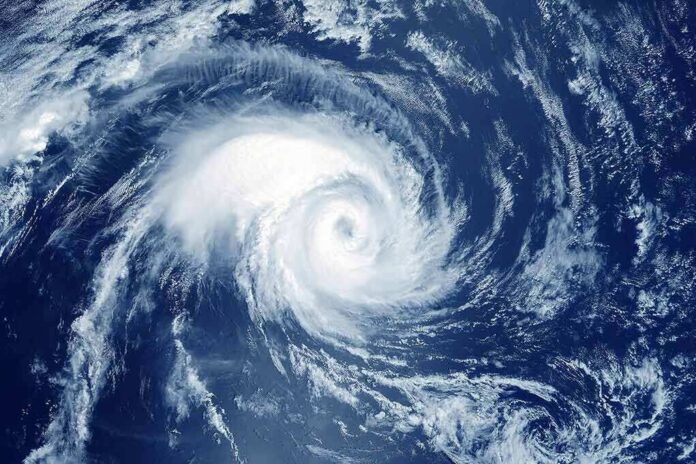
Hurricane Isaias grew into a major Category 3 storm with 120 mph winds and took aim at the northern Gulf Coast, forcing evacuations across three states.
Story Snapshot
- Isaias strengthened into the Atlantic season’s first hurricane, then rapidly grew to a major Category 3 storm.
- The National Hurricane Center issued a Storm Surge Warning from the mouth of the Mississippi River to Florida’s Suwannee River.
- A Hurricane Warning stretched from Ocean Springs, Mississippi, to the Bay/Gulf County line in Florida.
- Landfall was expected late Friday night or early Saturday between the Mississippi coast and the Florida Panhandle.
- Florida, Alabama, and Mississippi ordered evacuations as forecasters warned of surge, flooding, and tornadoes.
Storm Rapidly Intensifies Over the Gulf
Isaias strengthened into a hurricane late Wednesday before surging toward the United States Gulf Coast, the National Hurricane Center said. By Friday morning, the storm had grown into a major Category 3 hurricane with maximum sustained winds near 120 mph, churning roughly 195 miles south of Pensacola and moving north-northeast at 16 mph.
Forecasters tracked the storm closely as it moved across the southwestern Gulf of America before shifting toward the central Gulf. The National Hurricane Center had warned days earlier that residents along the northern Gulf Coast and Mexico’s Yucatan Peninsula should watch the system closely, predicting watches would likely be needed soon.
Warnings Cover Hundreds of Miles of Coastline
The National Hurricane Center placed a Storm Surge Warning in effect from the mouth of the Mississippi River to the Suwannee River in Florida. A Hurricane Warning covered the coast from Ocean Springs, Mississippi, to the Bay/Gulf County line in Florida, with a Tropical Storm Warning extending further west and east of those zones.
A storm surge warning means a danger of life-threatening flooding from rising water moving inland from the shore, generally within 36 hours of the warning being issued. The National Hurricane Center builds its surge maps from a model that accounts for many possible storm paths and intensities, not a single fixed outcome.
Evacuations Ordered as Landfall Nears
Florida ordered evacuations as Isaias closed in on the Gulf Coast, joining similar orders in Alabama and Mississippi. AccuWeather forecast landfall for Friday night or early Saturday as a strong Category 3 hurricane, with the flood threat growing as the storm pushed inland and north.
Forecasters said the storm was expected to make landfall somewhere between the Mississippi coast and the Florida Panhandle. That wide range reflects how track forecasts carry built-in uncertainty, even close to landfall, since storms can shift course in their final hours.
Storm Surge and Tornado Risks Extend Inland
In Bay County, Florida, officials said the storm’s forecast path shifted about 20 miles east in a single afternoon, with the center now aimed at Pensacola Beach. Peak storm surge of 5 to 7 feet above ground level was considered possible in the county, and forecasters gave Panama City better than even odds of tropical storm-force winds.
🌀 Gulf Coast – USA
Hurricane Isaias is forcing evacuations across Florida, Alabama and Mississippi, with storm surge potentially reaching 7 feet and rainfall up to 15 inches. The threat extends beyond the point of landfall, since flooding, tornadoes and prolonged power outages… pic.twitter.com/GK0yrpXyEt
— DARKCOM (@DARKCOMBUZZ) October 9, 2026
Beyond the coast, forecasters warned the storm’s wind field and rain bands would push tornado risk and flooding well inland, far beyond the immediate shoreline. The National Weather Service noted that life-threatening storm surge would strike the coast while damaging wind gusts spread across a wider stretch of the Gulf South.
Emergency crews moved into position ahead of the storm, with search and rescue teams deploying to the Gulf Coast before landfall. The storm’s rapid strengthening from a tropical storm to a major hurricane in a matter of days underscored how quickly conditions can change once a system moves over warm Gulf waters.
Sources:
youtube.com, nhc.noaa.gov, abcnews.com, journals.ametsoc.org