
Three people died after a Piper Comanche crashed in a remote North Rim area of Grand Canyon National Park, underscoring how hard it is to get straight answers fast when tragedy strikes far from help.
Story Highlights
- Park rangers found the wreckage and debris field; no one survived.
- Searchers used infrared and night-vision gear across rugged terrain.
- The site was in the Basin area near the North Rim, far from easy access.
- The National Transportation Safety Board will lead the investigation.
What Authorities Confirmed So Far
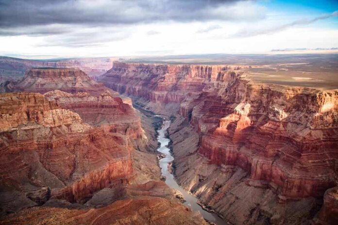
National Park Service staff said the Grand Canyon Regional Communications Center got a missing-aircraft report around 11:30 p.m. on November 15. Rangers located the aircraft and a debris field at about 10:15 a.m. on November 16. Officials reported three people were aboard the Piper Comanche, and there were no survivors. Names were not released. The site was described as the Basin area near the North Rim, a remote part of Grand Canyon National Park.
Local outlets, citing National Park Service updates and emergency responders, reported consistent core details. Reports matched on the aircraft type, the three people aboard, and the fatal outcome. One account attributed an estimated crash time to Sunday evening, while the official timeline centers on the missing-aircraft call and next-morning discovery. Authorities have not released photos of the wreckage or technical records at this stage.
How The Overnight Search Unfolded
Arizona Department of Public Safety air crews joined the effort soon after the missing-aircraft alert. Crews used forward-looking infrared and night-vision tools to scan rough canyon country in the dark. The area’s steep walls, high plateaus, and cold night conditions complicate searches and landings. After the night sweep, Park Service teams located the wreckage and a debris field the next morning. The terrain limited immediate public access and delayed visual confirmation for the broader public.
Officials described the crash area as remote, and early reporting varied on precise geography near the North Rim. Some outlets referenced the Basin area and the park’s no-fly rules more broadly, but no coordinates or airspace determinations were released. Without maps or a wreckage diagram, the public record remains focused on the verified facts: the search timeline, the location description, and the fatal outcome. Those points align across credible local reporting and park statements.
What Comes Next In The Investigation
The National Transportation Safety Board will lead the probe into what caused the crash. The National Park Service and the Federal Aviation Administration will support the work as needed. The National Transportation Safety Board cautions that preliminary reports summarize early facts and do not set the cause. Final findings often take many months and can reflect a mix of human, mechanical, weather, and terrain factors, not a single simple error.
🕯️ Grand Canyon plane crash
Went down ~7:15 p.m. Sunday, North Rim
Found Monday morning
3 killed, names not releasedCOMMENT 🕯️ for families#GrandCanyon pic.twitter.com/XwDHI3g8Pw
— RandomStuff A2Z (@RandomstuffA2Z) November 17, 2026
Families and the public will likely wait for clear answers. That slow path is normal in aviation cases and helps avoid snap judgments. For people on the right and left who feel institutions fail at their basic duties, the best guardrail here is patience and transparency. Officials should share timely, factual updates and release maps and records when possible. That is how trust is earned, even when the facts arrive one careful piece at a time.
Sources:
nypost.com, azdailysun.com, themirror.com, knau.org, ntsb.gov